Smarter Monitoring from the Sky

Aerial Intelligence for Pipelines, Environment and Infrastructure
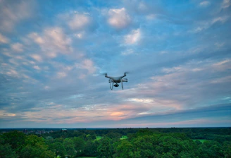
We deliver drone-based mapping, inspection and GIS reporting for safer assets, smarter land management and better project decisions
Drones for clear insights
We deliver precise maps, reports, and analyses instead of just flights.


Our Services
From pipeline checks to environmental monitoring – we provide reliable data.
Our Services
Drone-based inspection and GIS monitoring for infrastructure and the environment. Nature reserve management, measurement of CO2 sequestration, digital farming, pipeline surveillance, etc.
Pipeline Flights


Identify leaks, check vegetation, document damages.


Environmental Monitoring
Monitoring of forest condition, wetlands, and landscape management
Volume calculation, construction progress, and stability assessment.
Construction & Infrastructure
Subscribe now
Stay informed with our monitoring reports